top of page
shutterstock_1328182226.jpg

Surveying and Geomatics

For every surveying or geomatics project, we tailor our services to your on-site reality.

Our Custom Solutions

In the field of surveying, precision and data reliability are essential—whether for project development, cadastral operations, or land management.

At Soluscan 3D, we support municipalities, surveying firms, and developers with advanced solutions in 3D capture and modeling, topography, and mapping.

Our deliverables integrate seamlessly with your CAD tools, GIS systems, and land management platforms.

We are proud to partner with Aprentage PCB, a trusted reference in surveying.

Topographie & levés - Cadastral & bornage - Bathymétrie - SIG & géodonnées - Modèles numériques de terrain (MNT/MNS) - Études 4D & suivi temporel

Name_and_Logo.avif

Municipalities

Municipalities

Support land development projects and territorial management.

Tailored Services:

  • Topographic surveys for infrastructure projects

  • Orthophotos for land and cadastral analysis

  • Terrain models for urban planning

  • GIS mapping for regulatory visualization

  • Monitoring of public worksites

Real Estate Developers

Secure development projects right from the site phase.

Tailored Services:

  • Surveying for site layout plans

  • 3D models of existing sites

  • Mapping of topography and easements

  • Orthophotos for urban planning documentation

  • Site staking and boundary marking

General Contractors

Plan and execute work based on reliable data.

Tailored Services:

  • Pre-construction site surveys

  • Precise layout of foundations and infrastructure

  • Elevation modeling for grading and leveling

  • Construction monitoring via drone or GIS

  • As-built plans upon project delivery

Surveying Firms

Enhance the efficiency and precision of technical mandates.

Tailored Services:

  • High-definition orthophotos

  • LiDAR point clouds and photogrammetry

  • Usable 3D models for calculations

  • Digital terrain models (DTMs)

  • GIS tools for deliverable structuring

Geomatics Professionals

Deliver accurate and compliant reference data.

Tailored Services:

  • Enriched geospatial data for cadastral plans

  • Integration with drawing and calculation software

  • Complementary drone surveys

  • Modeling of existing structures

  • Site monitoring and image-assisted boundary surveying

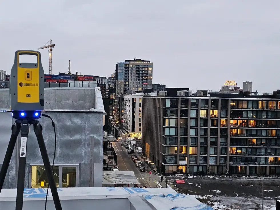
3D survey on an urban construction site for a development project in Quebec

Ready to bring your surveying project to life?

At Soluscan 3D, we're here to provide you with reliable, precise data that's ready to integrate into your tools. Whether you're in the study phase, implementation, or construction monitoring, our team adapts to your on-site reality.

Relevé 3D sur chantier urbain pour projet d’aménagement au Québec
Orleans Island Bridge

LiDAR topography and bathymetry

SEE  THE PROJECT

Relevé 3D sur chantier urbain pour projet d’aménagement au Québec
Private land

Lidar scanning by drone

SEE  THE PROJECT

Relevé 3D sur chantier urbain pour projet d’aménagement au Québec
Festival sportif

Drone photogrammetry

SEE  THE PROJECT

Relevé 3D sur chantier urbain pour projet d’aménagement au Québec
Plant City USA

Drone Photogrammetry and Digital Twin

SEE  THE PROJECT

Relevé 3D sur chantier urbain pour projet d’aménagement au Québec
Denver Church 3D

Drone Photogrammetry and Digital Twin

SEE  THE PROJECT

Relevé 3D sur chantier urbain pour projet d’aménagement au Québec
Complete City Scan

Complete City Scan

SEE  THE PROJECT

Relevé 3D sur chantier urbain pour projet d’aménagement au Québec
Volume of gravel pits

Volumetry by drone

SEE  THE PROJECT

Relevé 3D sur chantier urbain pour projet d’aménagement au Québec
Société VIA

Drone photogrammetry and digital twin

SEE  THE PROJECT

Relevé 3D sur chantier urbain pour projet d’aménagement au Québec
Bureau ABS

2D Plan - Office

SEE  THE PROJECT

Relevé 3D sur chantier urbain pour projet d’aménagement au Québec
St-Damien

2D plan

SEE  THE PROJECT

Relevé 3D sur chantier urbain pour projet d’aménagement au Québec
McGill

3D model

SEE  THE PROJECT

Relevé 3D sur chantier urbain pour projet d’aménagement au Québec
Résidence Ophélia

2D facade and topography

SEE  THE PROJECT

Relevé 3D sur chantier urbain pour projet d’aménagement au Québec
MTL pool

3D model

SEE  THE PROJECT

Relevé 3D sur chantier urbain pour projet d’aménagement au Québec
Bathymétrie NDDP

Bathymetry

SEE  THE PROJECT

Relevé 3D sur chantier urbain pour projet d’aménagement au Québec
Beauharnois ABS

Vectorization

SEE  THE PROJECT

Relevé 3D sur chantier urbain pour projet d’aménagement au Québec
Hydro QC

Drone Photogrammetry and Vectorization

SEE  THE PROJECT

Relevé 3D sur chantier urbain pour projet d’aménagement au Québec
Westrock

Feasibility and Positioning Analysis

SEE  THE PROJECT

Relevé 3D sur chantier urbain pour projet d’aménagement au Québec
Nordic

3D modeling

SEE  THE PROJECT

Relevé 3D sur chantier urbain pour projet d’aménagement au Québec
TC imprimerie

Taking complex measurements

SEE  THE PROJECT

Relevé 3D sur chantier urbain pour projet d’aménagement au Québec
Découpeuse BA

Feasibility and Positioning Analysis

SEE  THE PROJECT

Relevé 3D sur chantier urbain pour projet d’aménagement au Québec
Floor flatness

Surface analysis

SEE  THE PROJECT

Relevé 3D sur chantier urbain pour projet d’aménagement au Québec
CSBE

Motion analysis

SEE  THE PROJECT

Relevé 3D sur chantier urbain pour projet d’aménagement au Québec
Église St-Prosper

Verticality analysis

SEE  THE PROJECT

Relevé 3D sur chantier urbain pour projet d’aménagement au Québec
Barrage Betsiamites

Drone Photogrammetry and Geological Inspection

SEE  THE PROJECT

Relevé 3D sur chantier urbain pour projet d’aménagement au Québec
AKG escalier

Complex Measurements and Quality Control

SEE  THE PROJECT

Relevé 3D sur chantier urbain pour projet d’aménagement au Québec
AKG vitre

Quality Control and Deviation Analysis

SEE  THE PROJECT

Relevé 3D sur chantier urbain pour projet d’aménagement au Québec
Glenstone

Taking complex measurements

SEE  THE PROJECT

Relevé 3D sur chantier urbain pour projet d’aménagement au Québec
DLG Podium

Complex Measurements and Vectorization

SEE  THE PROJECT

Relevé 3D sur chantier urbain pour projet d’aménagement au Québec
Washington NASM

Complex Measurements and Deviation Analysis

SEE  THE PROJECT

Relevé 3D sur chantier urbain pour projet d’aménagement au Québec
Quartier Général

Taking complex measurements

SEE  THE PROJECT

Relevé 3D sur chantier urbain pour projet d’aménagement au Québec
City point core

Taking complex measurements

SEE  THE PROJECT

Relevé 3D sur chantier urbain pour projet d’aménagement au Québec
Adamus MTL

Positioning and Deviation Analysis

SEE  THE PROJECT

Relevé 3D sur chantier urbain pour projet d’aménagement au Québec
Truss deviation

Deviation Analysis

SEE  THE PROJECT

Relevé 3D sur chantier urbain pour projet d’aménagement au Québec
Wingwell

3D scanning

SEE  THE PROJECT

Relevé 3D sur chantier urbain pour projet d’aménagement au Québec
Columbia University

Positioning and deviation analysis

SEE  THE PROJECT

Relevé 3D sur chantier urbain pour projet d’aménagement au Québec
Luxuor

Positioning and deviation analysis

SEE  THE PROJECT

Relevé 3D sur chantier urbain pour projet d’aménagement au Québec
Linden grove

Deviation analysis

SEE  THE PROJECT

Relevé 3D sur chantier urbain pour projet d’aménagement au Québec
Castconnex

Quality Control, Positioning, and Deviation Analysis

SEE  THE PROJECT

Relevé 3D sur chantier urbain pour projet d’aménagement au Québec
One city

Quality control

SEE  THE PROJECT

Relevé 3D sur chantier urbain pour projet d’aménagement au Québec
AKG Panthéon

Quality control and 3D modeling

SEE  THE PROJECT

bottom of page